£100 - £200
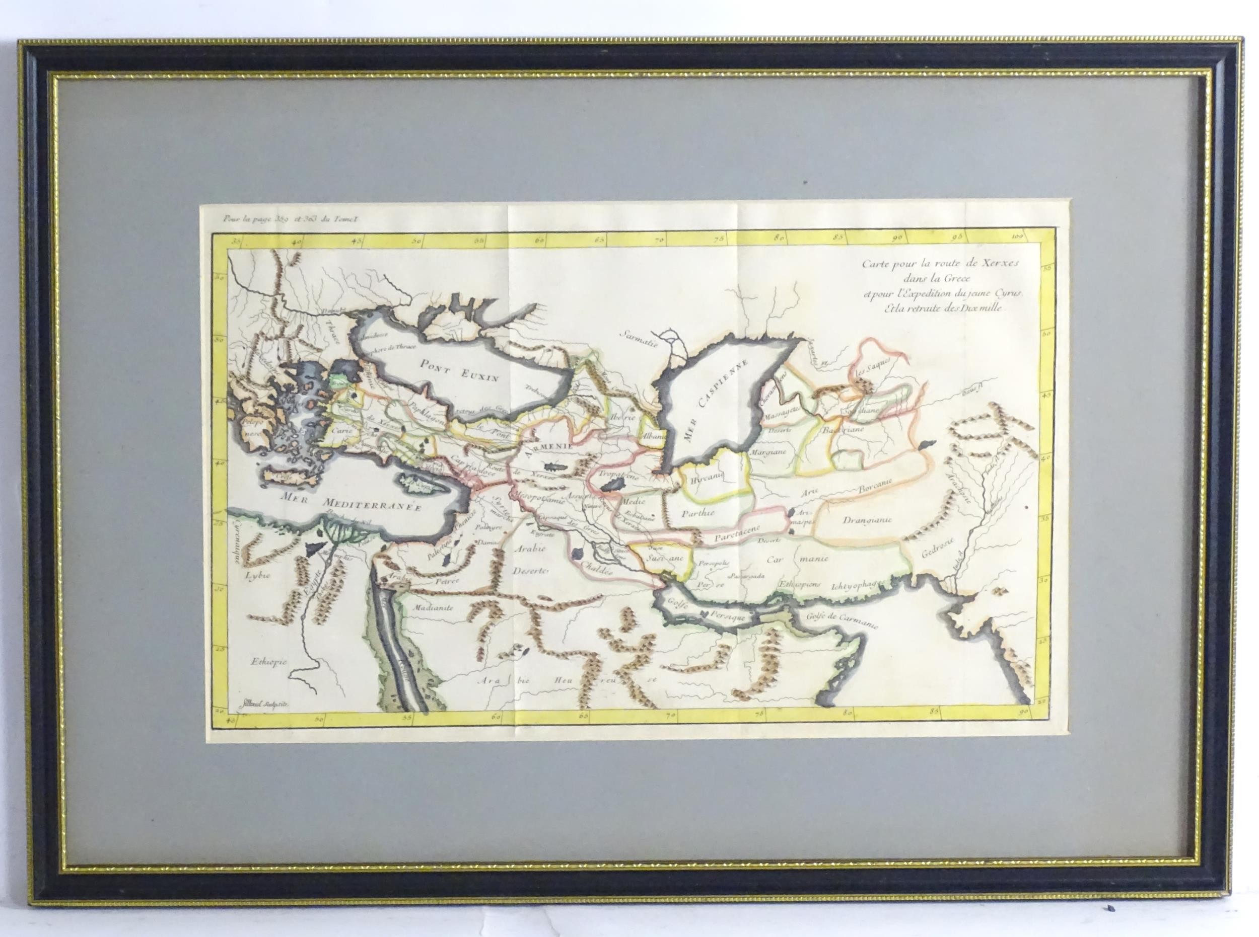
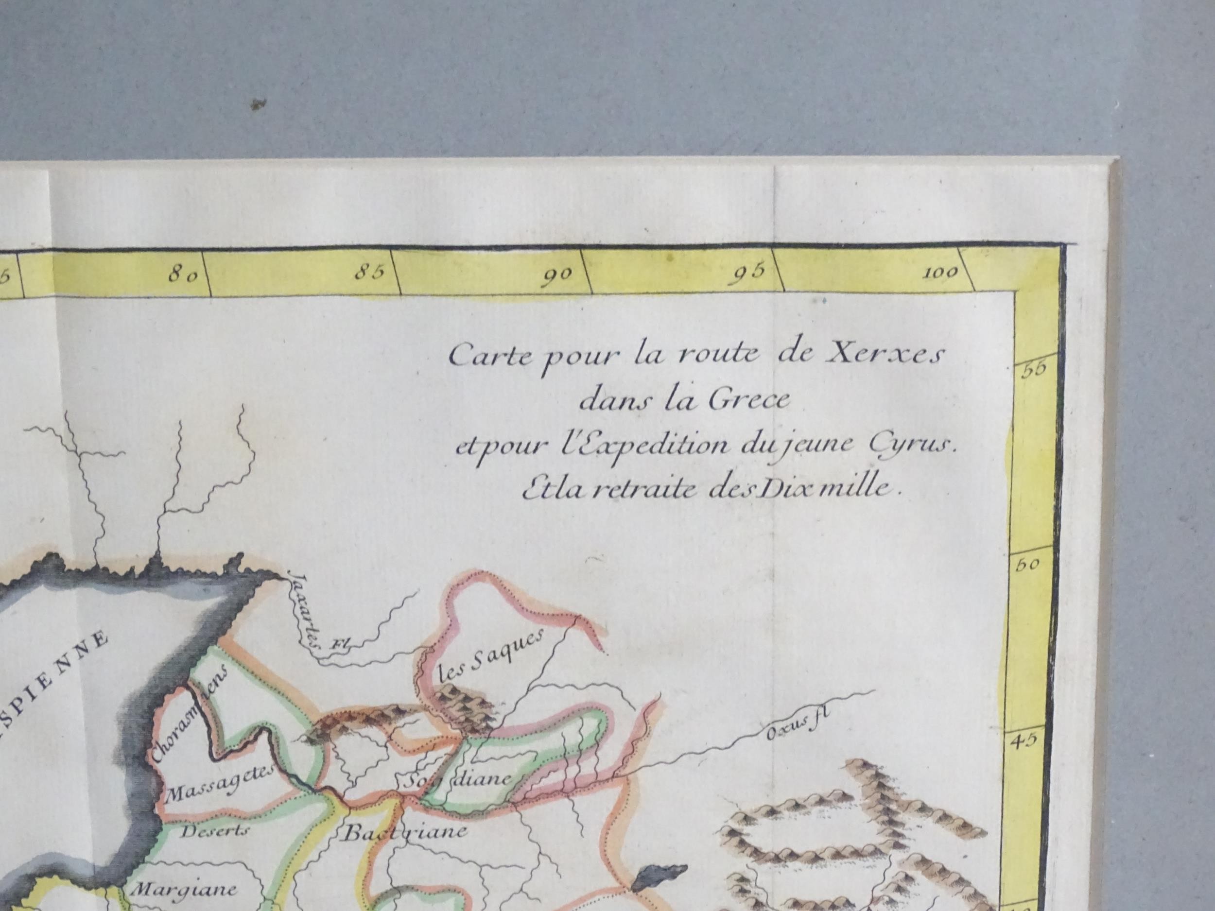
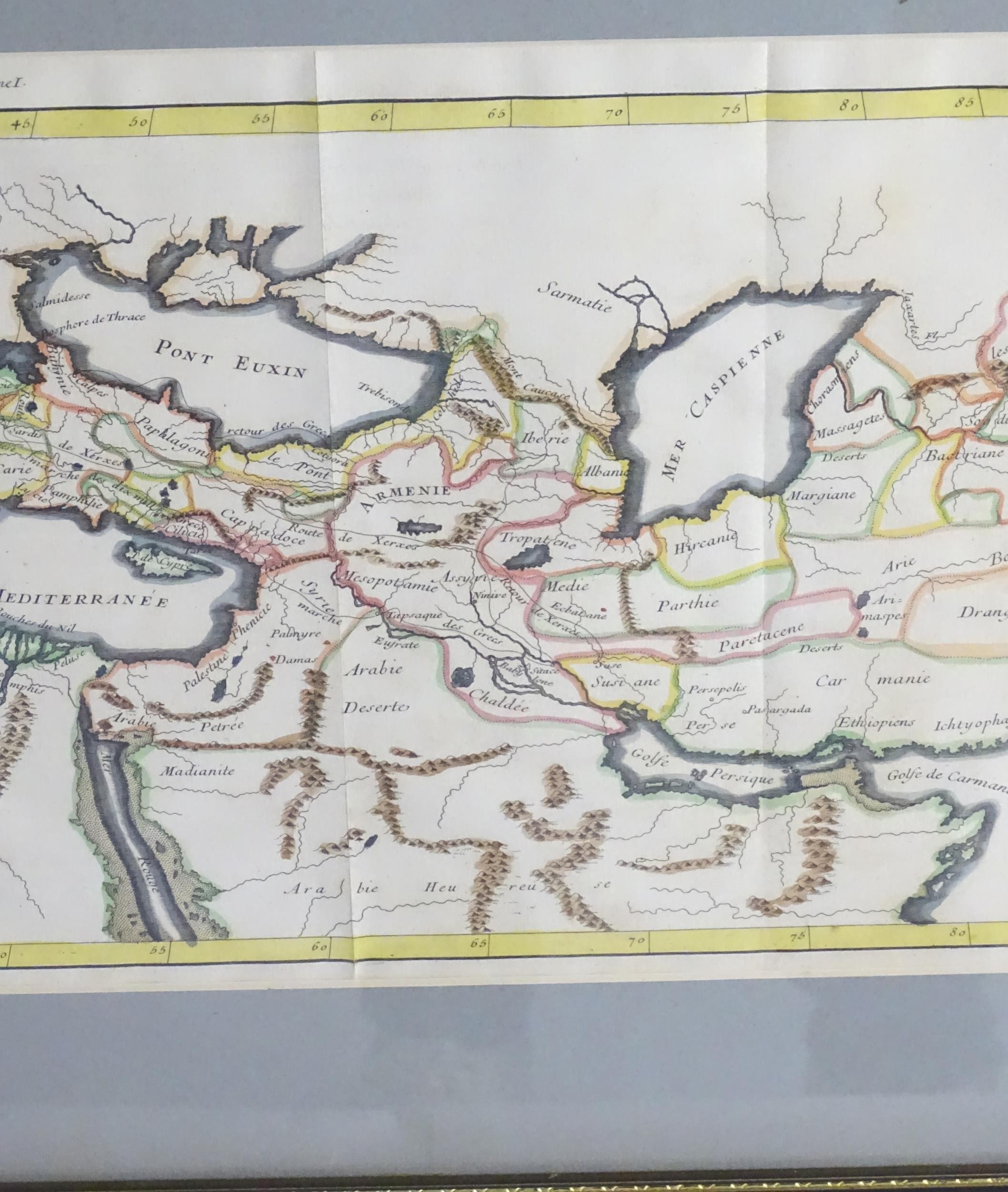
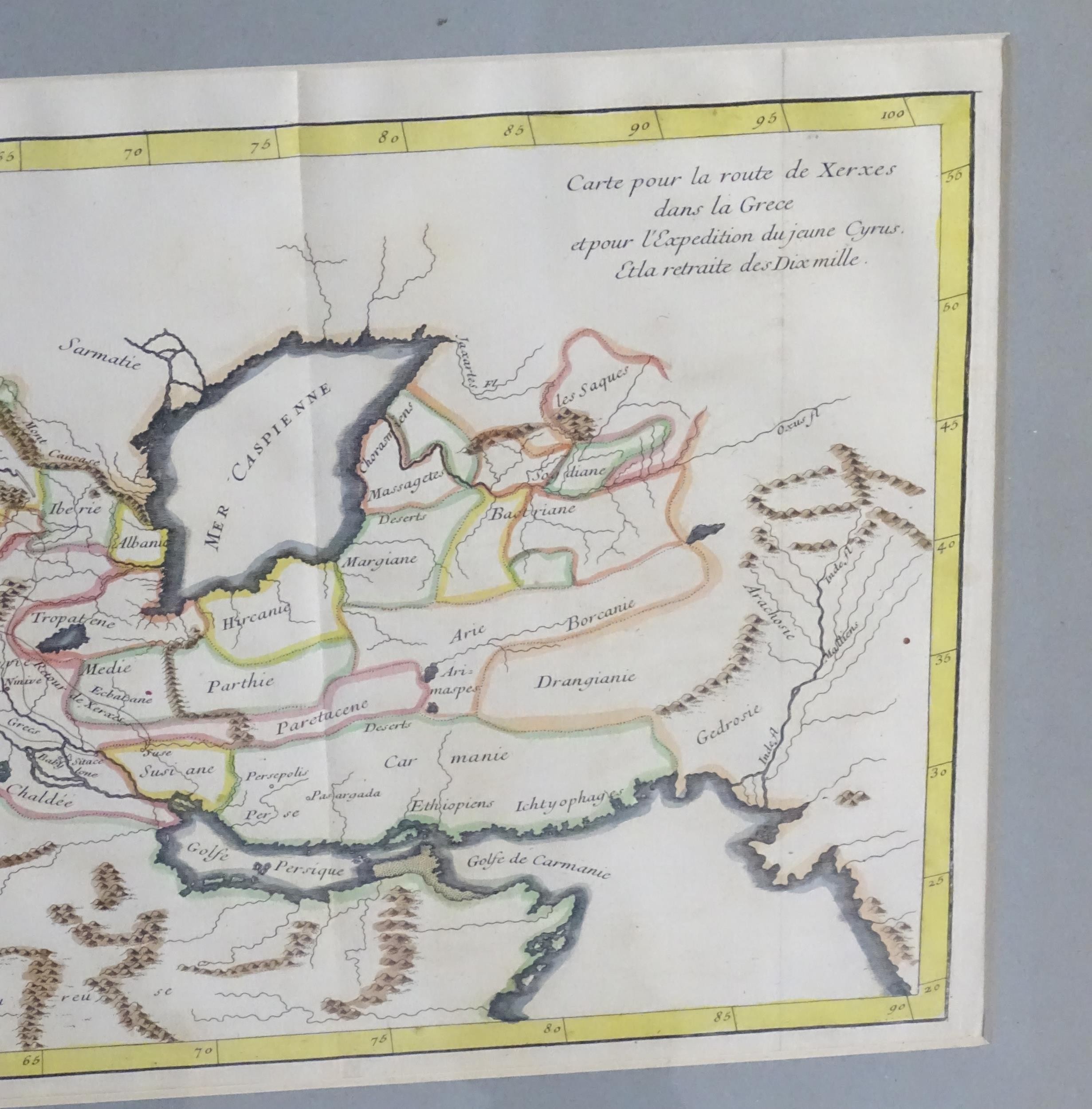
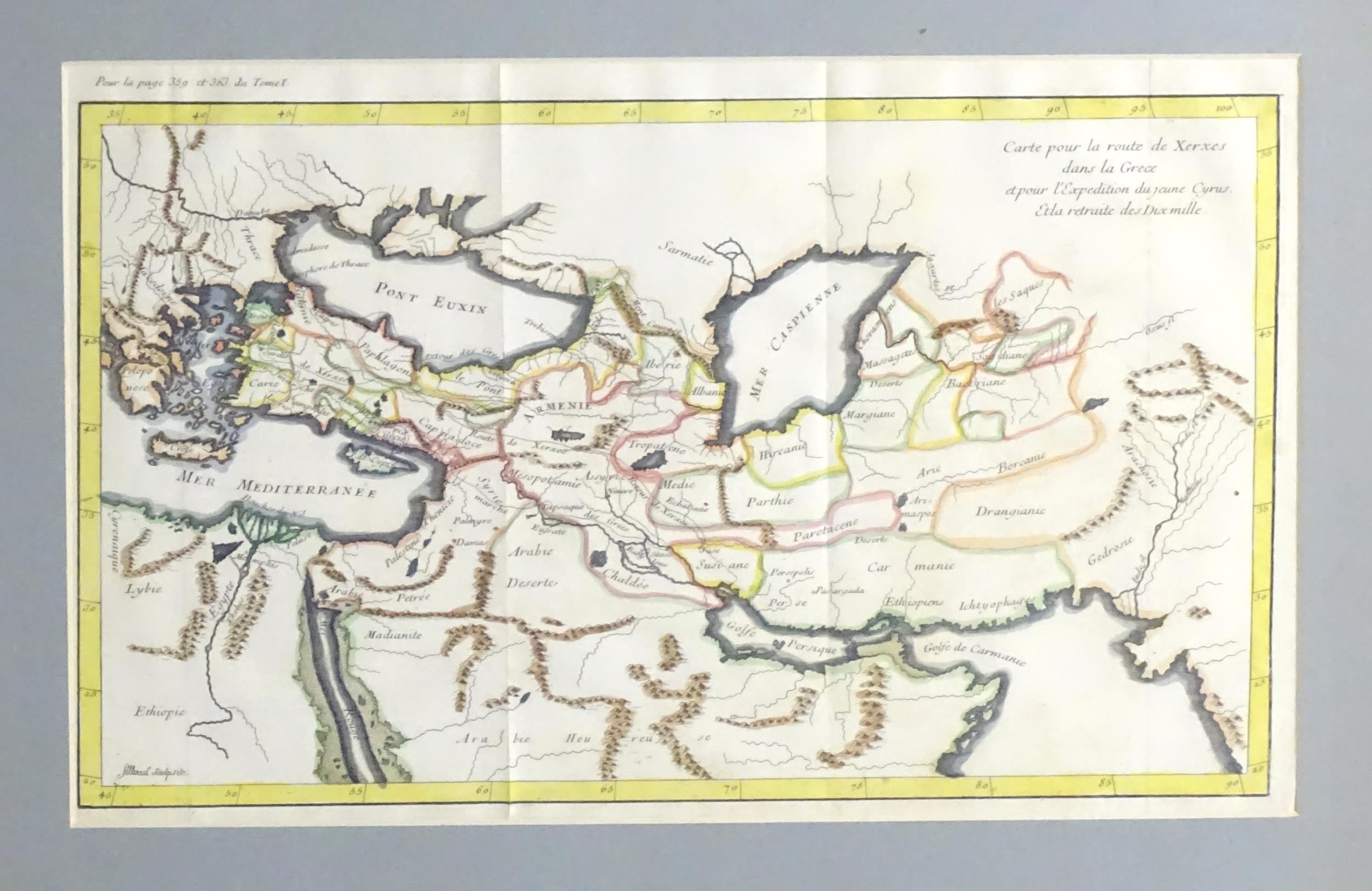
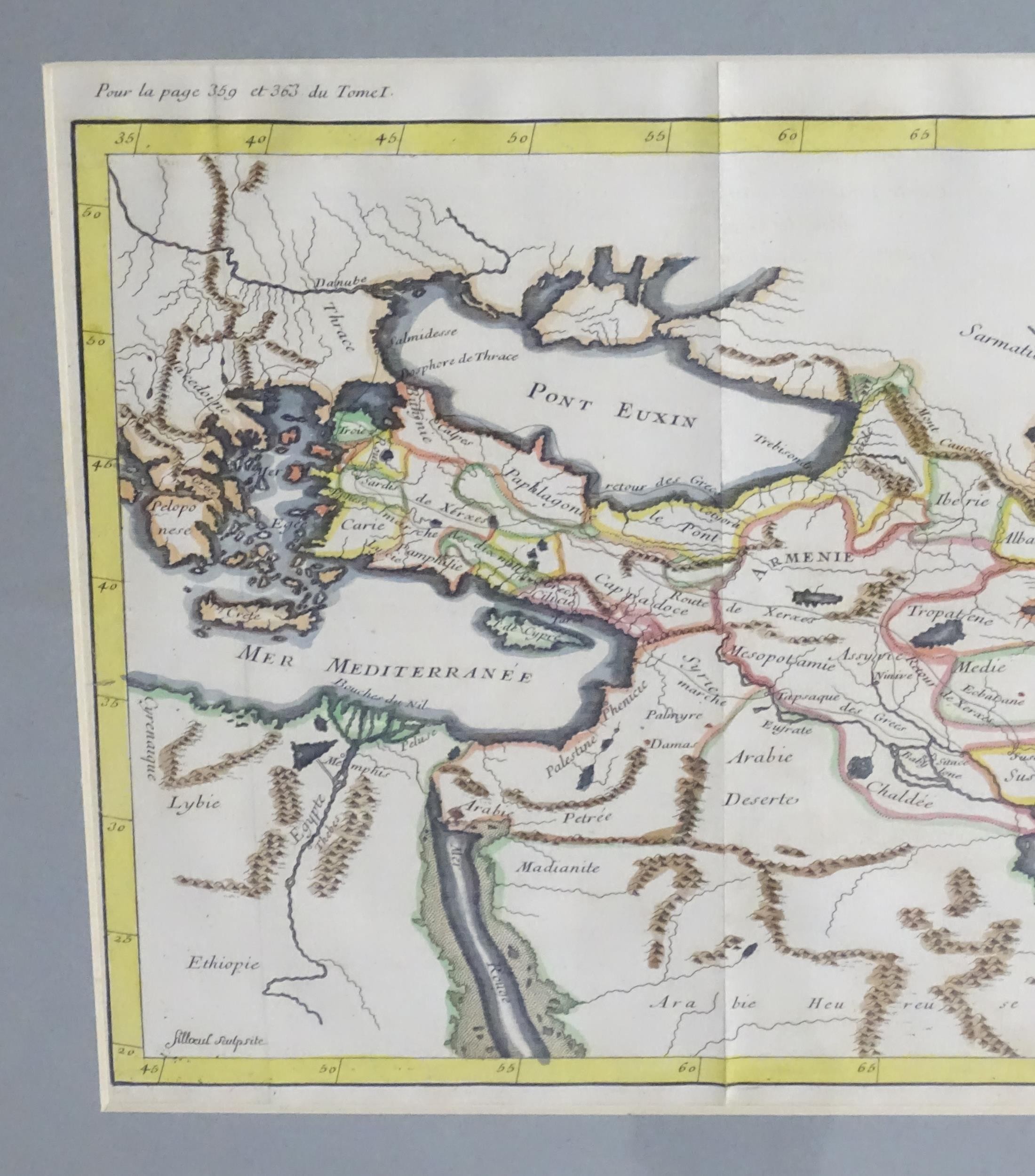
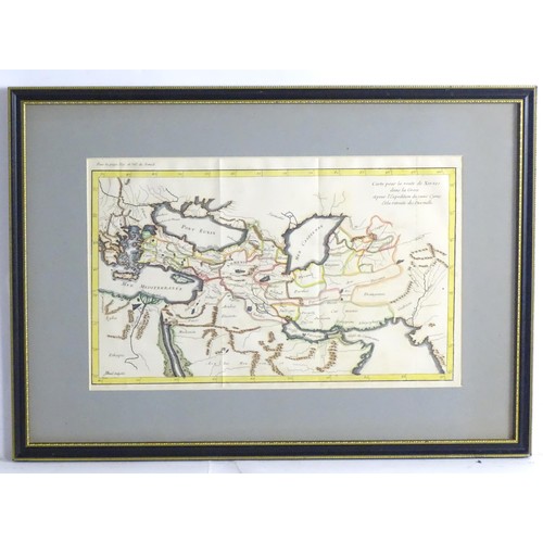
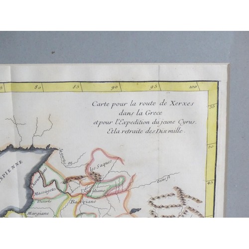
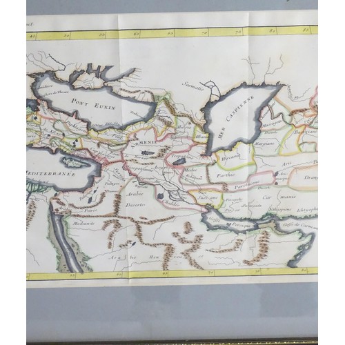
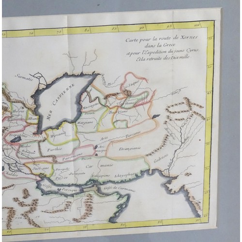
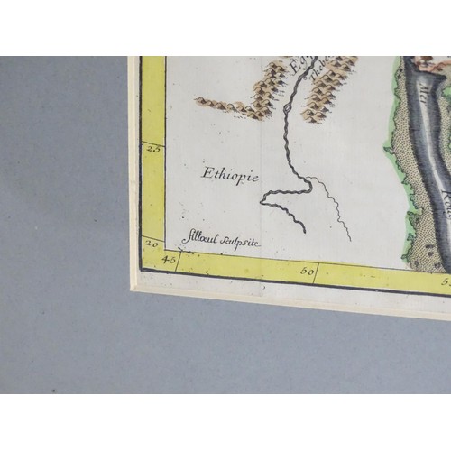
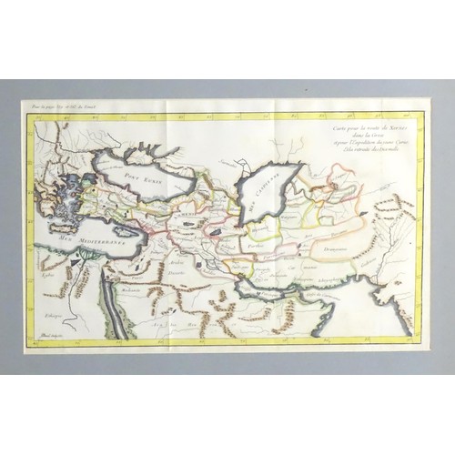
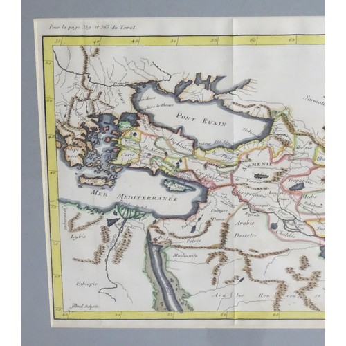
Map: An 18thC Middle Eastern hand coloured map titled Carte pour la Route de Xerxes dans la Grece et pour la Expedition du Jeune Cyrus et la Retraite des Dix Mille. Showing the Peloponese in the West to the Indus in the East, tracing Xerxes route in 480 B.C. with historical sites marked. Published by Filloeul, Paris, 1729. Approx. 8 1/2" x 16"
Please Note - we do not make reference to the condition of lots within descriptions. We are however happy to provide additional information regarding the condition of items on request.
Fees apply to the hammer price:
Room and Absentee Bids:
23.4% inc VAT*
Online and Autobids:
26.4% inc VAT*
Join our mailing list and receive the latest auction catalogues